Route description SΜF 2015
Route description Xco
Event has the starting and finishing lines on the Hill of Prophet Elias and runs along forest and agricultural tracks. Of the 5km, 2km is along walking tracks and the altitude reaches 160 m. The route is on earth with no stone and the paths are pleasurable and take the athletes through a tunnel of natural beauty.
Xco Course Map C2 UCI

Sfendami XCO Course Elevation Map
Elevation per lap :159 Meters
Lower Altitude :220 Meters
Higher Altitude :310 Meters
Route Specification RUN
Lower Altitude :73 meters
Higher Altitude :300 meters
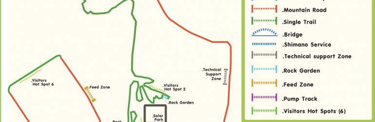
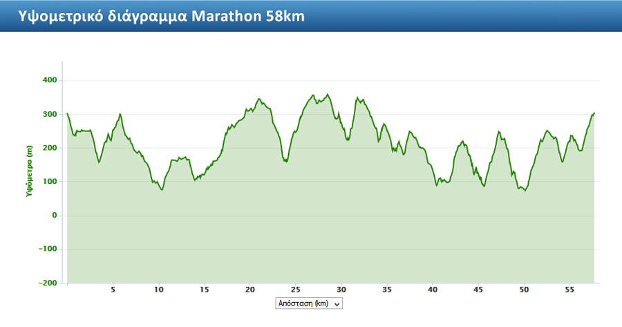
XCM MARATHON C3 & UCI

RUN & MTB Fun Race Route (23km)

Agricultural Track : 13.5 km
Single Track : 9.5 km
Race safety
Throughout the event there will be a rescue team of 40 members available at many points and in full communication for quick recovery